
Tags
A-Z Wilds Duology Challenge, adventure fantasy, Author's Notes, fantasy romance, Fiction, gay romance, LGBT, Love, M/M, Novel, Romance, Series, Writing
 Maps…ha. You probably wish I had some professional artist create something resembling my countries. In fact, after looking at my photos, you’ll probably wish for someone whose handwriting you can read :P
Okay, in all seriousness, I drew the maps solely for myself to get a sense of direction when I was writing these two novels. These ones were more for Song for the Wilds (Book II) since the bulk of that novel takes place in the plane of Nebrae. The scribbles I used for Haunt of the Wilds will be shown on Nov. 25th for V for Virdaemn Maps.
This first map I drew was to give myself an understanding of how big the wilds territory was. I’m awful when it comes to pictures so hopefully these come out okay enough to see.

That huge section throughout the bottom left? That’s the wilds, both the edge wilds and the deep wilds. To the right where that small section is unattached by a strait? Yes, I know I misspelled strait. You can tell I realized it and scribbled over it uselessly. Anyway, I’m not entirely sure what I want to do with that portion of land. I just put it there for fun.
The place I’ve ovaled (is that a word? WordPress tells me no, but then wordpress isn’t a word either so :P), with the islands and peninsula, is Coaistal Shores. It gets mentioned, but the characters don’t actually go there. The city along the coast, Ca’ryl, also get mentioned a few times. I have story ideas for it, but I haven’t gotten around to them yet.
Then, of course, there is the important part of the map. See the middle where that dark two-lined area is? That’s the Braken. It gets mentioned in the first sentence in Haunt of the Wilds and becomes incredibly important. It’s also where the novelette, Fateful Hunt, with De’vii’s parents, takes place.
Above the Braken is Ay’ril Woods.
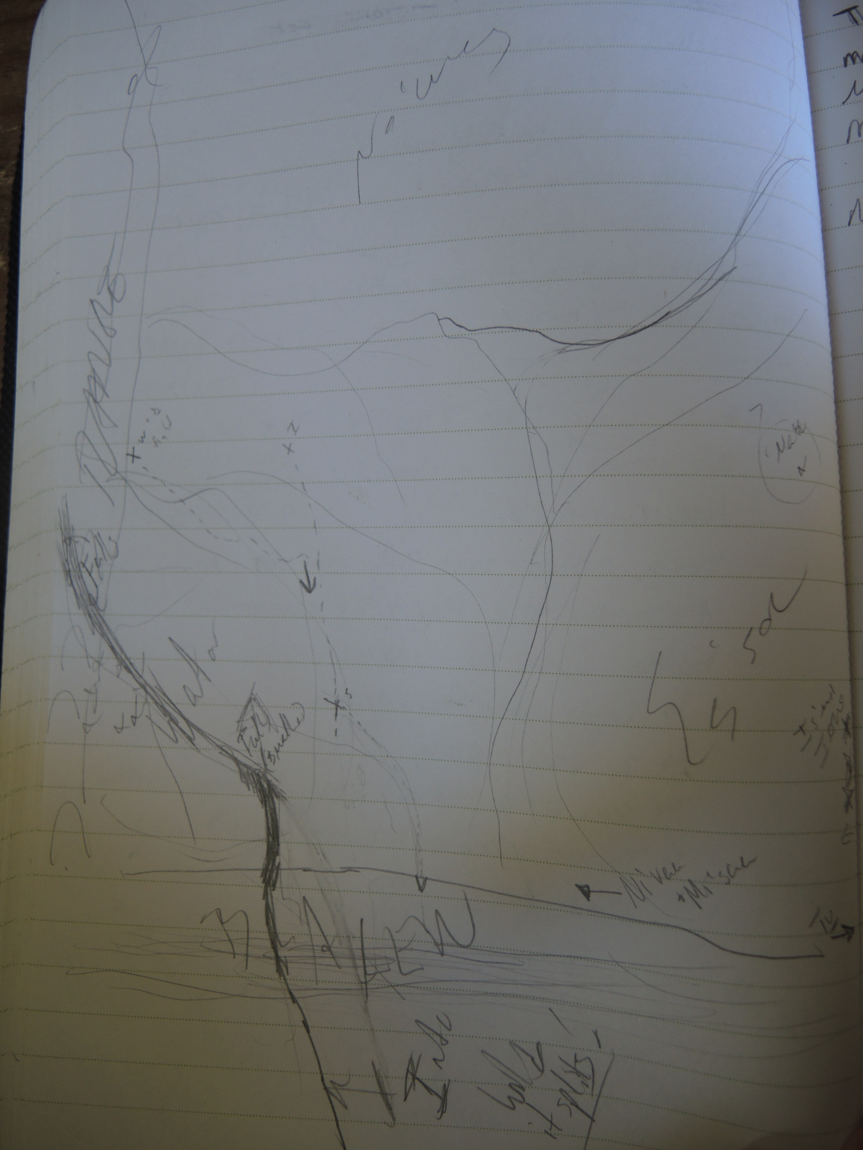
And here is where my crappy handwriting becomes even more apparent. This photo is of Ay’ril Woods, divided into the three packs who live there. The Braken runs along the bottom of the photo. I only have this here to show the northern pack area (No’wes), the eastern pack (Es’sou) and the western (left side in photo) one along the mountain range (Wa’tor). That last is where De’vii’s sire comes from.
But, yeah, here is one a little closer up of the important bits:
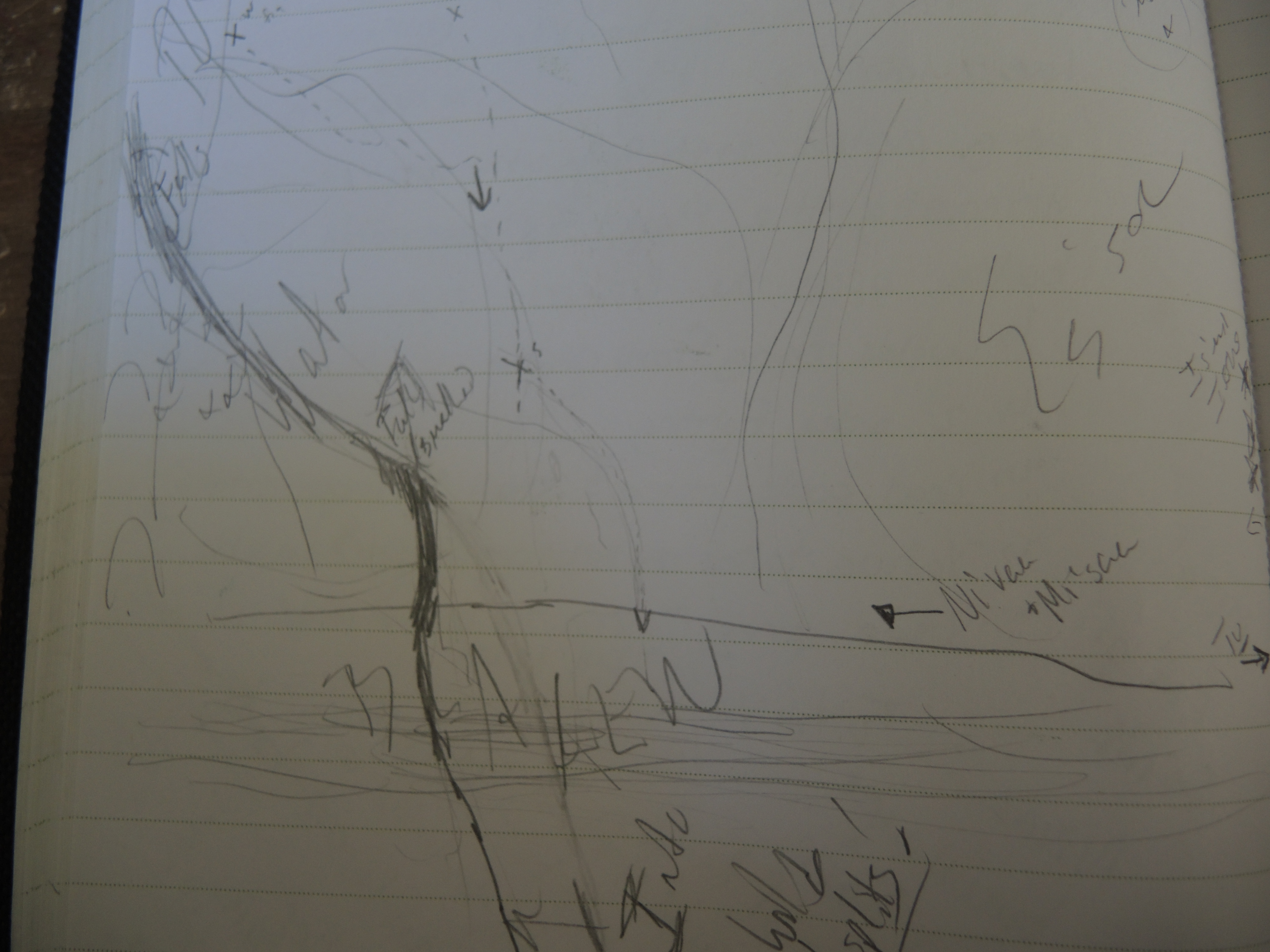
The dark line is a river that looks nothing as it really would. There are two places I’ve marked where the rivers turns into falls, one within the mountain range that runs along the left-hand side of the page. Use your imagination that those little lumps I drew are actually mountains :)
There are also dotted lines that cut through the forest–because this entire map is of a forest even if I didn’t draw trees. There are Xs and initials indicating events and direction and paths, etc. I won’t explain them because that would be spoiling a few things in Song for the Wilds.
In the bottom right-hand corner of the last photo you can see where I’ve written “Tu” with an arrow. That’s an indication where a hostel is located off map. Above that is a very out of proportion ‘town’ along the edge of Es’sou territory. That area technically should be more of a dot than the line of Xs I’ve made it into.
I’ve also written “Ni’vaa and Mi’saa” in the forest north of the Braken. Mi’saa is De’vii’s best friend. Ni’vaa doesn’t get introduced until Song for the Wilds, so you’ll just have to wait to meet him :)
And thus ends my crappy map-making skills until V.
As a fun side note, the name Nebrae comes from the Latin word tenebra/tenebrae meaning dark or night since there is no sun within Nebrae :)
